by Dan Woodhead
My son Mark set up a mountain biking tour in the Moab, Utah, area in early October, 1996. The touring company owner, Lou Warner, of Western Spirit Cycling (WSC), advised him that late September or early October was the window of opportunity for the tour Mark wanted. Any earlier and you’d broil in the desert; any later and you could freeze in the mountains. The tour was to combine jeep roads through the Canyonlands area just north of the Grand Canyon, and single track (foot paths) in the Abajo Mountains about 50 miles south of Moab.
I flew to Denver and then down to Grand Junction in a smaller plane, rented a car and drove down the Colorado to Moab. It was raining when I arrived. The group was to meet that evening in Eddy McStiff’s brew pub in Moab. I sat at the bar, drinking club sodas, and watching for my kids, their significant others, and the rest of the group, whom I didn’t know. No luck. Eventually, I had some dinner at the bar, then went to my motel room and turned in.
Next morning at WSC, I met Mark and my daughter Leigh, Caroline, Mark’s girlfriend, Jason, Leigh’s boyfriend at the time, and the rest of the group-all friends and acquaintances of my son. There were nine of us in all. Caroline’s truck had had alternator trouble on the way, and they and Leigh and Jason, who were convoying with them, had stopped overnight in Nevada for repairs.
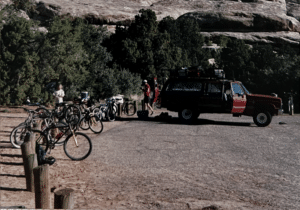
We got acquainted with the WSC staff and made preparations for the trip. I’d rented a mountain bike from WSC, rather than drag my old beat-up mountain bike out to Utah. Lou Warner assigned me a totally cool fully suspended shiny aluminum Fisher Joshua as the rental bike I would ride. We stuffed our luggage into waterproof river runner duffle bags. The one hitch was that the rain the previous night had dumped a lot of snow in the Abajos, and that was where we were scheduled to ride. So Lou and his staff were scrambling to set up an alternative plan.
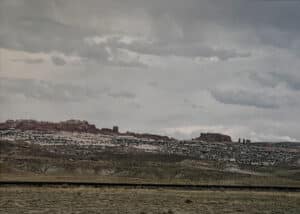
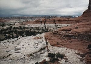
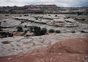
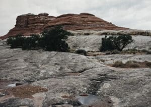
While WSC staff worked on new arrangements, Lou had us saddle up and we headed up the road from WSC to the Sand Flats area, where the Slickrock Trail was. The trail runs over a wide, open area of fossil sand dunes that were turned to red sandstone ages ago. It’s a wild place. But first we had to get there, and we had a couple of miles of steep uphill paved road to cover. We were at about 4,800 feet there, and the altitude was noticeable as we ground up the hill in low gears— a hint of what it would be like at 9,000 or 10,000 feet in the mountains.
Lou led us on his own personal version of the Slickrock Trail, and coached us on how to handle the trickier parts of it. Around noon, we rode back down to WSC for a picnic lunch in the parking lot. WSC staff had lined up a reservation at a group camping site at Squaw Flats down in the Needles area of the Canyonlands National Park. We loaded the bikes and luggage onto the roof of a WSC 4WD GMC Carryall, climbed in, and headed down to Squaw Flats.
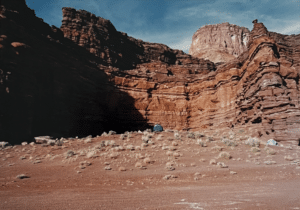
At the camp site, we unloaded our gear and bikes, and leaned the bikes against the posts that separated the park road from the camp site. Park Service rules are that bikes are NOT allowed off the road, and Lou warned us that the Park Service takes those rules very seriously. So we left a dozen expensive mountain bikes leaned against posts by the side of the road, unlocked, while we made camp. It made us nervous, but Lou said it was safe enough.
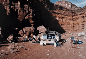
Lou, and the other guides for our trip, Milly, and Jeff, who was just breaking in as a guide, set up the cooking area, started a campfire, and cooked dinner. They have this down to a science, and they do it well. WSC’s motto is “Civilized tours in uncivilized country,” and they live up to it. We sat around the campfire for a while after dinner, and then went to our respective tents and turned in.
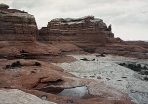
Next morning after breakfast and cowboy coffee (loose grounds settled with an egg in a big enameled coffee pot), we made sandwiches for lunch, and headed out from the camp site on a jeep trail to an overlook to the confluence of the Green and Colorado Rivers. The jeep trail went up over Elephant Hill, a legendary place in those parts. The trail up Elephant Hill looked to me like an enormous pile of boulders. Those of the group with really good mountain bike handling skills rode up it. The rest of us rode parts of it, and pushed our bikes up the harder parts. The other side was like the first, but more dangerous, since it’s a lot easier to get into trouble going down terrain like that. Prudence dictated walking the worst parts.
Down on flat (or flatter) ground again, we found sand. Lou had hoped that the recent rains would have firmed up the sand, so we could ride it. That didn’t work out. Parts of the jeep trail (where there was more clay in the soil) could be ridden. In other parts, you’d be going along, and the bike would slowly come to a stop, although your pedals were still going around. Generally, the next move was to fall over, unless you could unclip a foot quickly enough. Trying to ride through, and even pushing the bikes through, that sand sucked the energy out of our bodies.
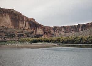
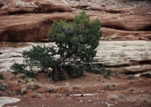
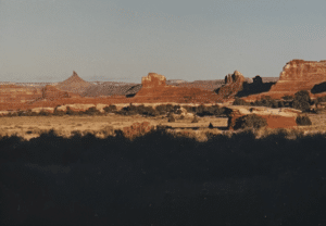
The confluence of the Colorado and Green Rivers was wonderful. The Green River is really green, due to copper-rich silt in the area it runs through, and the Colorado, was red (colorado means red in Spanish), due to iron oxide in the deposits being eroded along its course. We could see the green and red waters running along for a while and gradually mixing, far below us in the canyon.
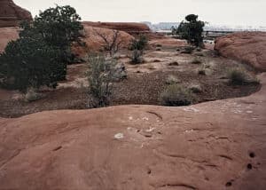
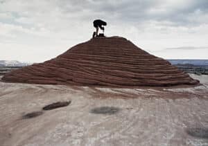
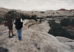
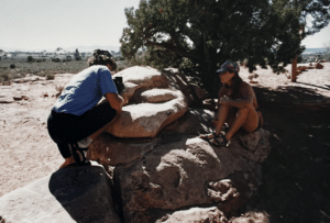
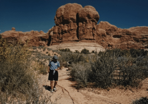
After eating lunch and resting at the overlook, we headed back through the sand, and up over Elephant Hill to our camp site. While the WSC crew was getting dinner ready, Mark, Caroline and I walked around (and climbed on the slick rock by the camp site, and took pictures. Dinner was good, but we probably wouldn’t have noticed if it wasn’t, we were so hungry. We sat around the campfire, and tried to identify constellations (the stars are really bright out there, far from any town). No one stayed up very late.
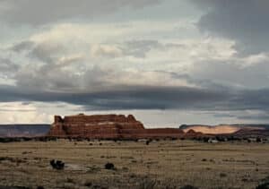
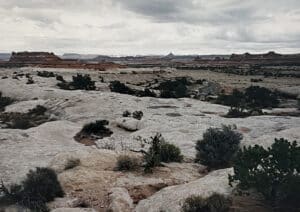
Next morning we broke camp. We headed back toward Moab on a 2-day ride along the Lockhart Basin Trail, a long jeep road that meanders through the desert along the side of an upland on BLM land. At one point, we stopped, leaving our bikes by the side of the road, and walked along places where water had flowed, so as not to step on the fragile cryptobiotic crust that covers the desert soil, and keeps it from blowing away. Lou pointed out Indian arrowheads. You can pick them up and look at them, but you have to drop them more or less where you found them. Otherwise, tourists would eventually carry away all of Utah or at least the more interesting and portable bits. We climbed up a slope and examined some Indian ruins. With these, the rule is even stricter-look, but don’t touch, even on BLM land, where rules tend to be more relaxed than in the national parks.
We stopped for lunch at a stream with pools you could swim in, and a small waterfall. It was near some Indian ruins that seemed to be granaries, rather than places to live. An idyllic spot, except for a family with several 4-wheel ATVs and off-road motorcycles, who shared it with us. They spend the time we were there running around in the sand with their vehicles whining and snarling.
Lou observed that the BLM (jokingly referred to by everyone but the rape and pillage crowd as the “Bureau of Leasing and Mining”, because it leases the public land at low cost to ranchers for grazing cattle, and to mining companies for exploiting the minerals) is something of a mixed blessing. On the one hand, it’s friendly to mountain bikers (which the Park Service is not), but on the other hand, it’s friendly to fossil fuel-powered land users like our companions at the lunch stop, and to the mining and ranching interests.
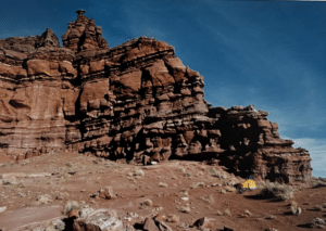
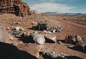
We camped that night in a kind of cove in the mesa on our right. The cliffs over our camp site were spectacular. Again, WSC staff cooked a great dinner Mexican this time, with peach cobbler for dessert, cooked in a cast iron pot covered with charcoal briquettes.
They had brought bathroom facilities: a portable shower whose reservoir had been warming on the roof of the van during the day, and a portable toilet, since we were out on BLM land, where there were no prepared camp sites with toilets. Both shower and toilet had a great view of the road and the desert (and vice versa), sitting up on the talus slope at the foot of the cliff, out of direct sight of the camp site. The key to the washroom was the roll of toilet paper sitting on the hood of the GMC Carryall. Take the roll, and your fellow campers were notified (theoretically) that the open-air washroom was occupied.
Next morning after breakfast, Lou warned us that we would be out of reach by vehicle, so we should follow expedition rules, check to make sure our bikes were in good shape and ride cautiously, so we wouldn’t have to be rescued. Mark mentioned that he’d found the source of the creaking he’d been looking for the last 3 weeks in his Santa Cruz bike. There was an inch-long crack in the seat tube of the aluminum frame. Lou offered him one of the spare bikes from the van, but Mark declined. He wanted to grow the crack a little bit, so he could get the frame replaced under warranty. And it was growing pretty slowly, so he was confident it would be all right. He would stop jumping, however, he said.
We headed on along the Lockhart Basin jeep trail toward Moab. It would be a 50-mile ride this day. Mostly, it was flat, with good firm soil in the wheel ruts of the trail. Occasionally, we rode through short patches of soft sand, which we could generally let our momentum carry us through. Occasionally, the trail rose and went over ledge close along the mesa on our right. At those times, we sometimes had to climb 4 to 6-inch steps in the ledge, and dodge small rocks.
It wasn’t exactly a smooth ride. In at least one section, the trail led through very technical (difficult) terrain. It was good to have suspension in those conditions. Caroline was having trouble with her back, and had to stop and have Mark massage it to ease the pain from tension every so often. I noticed that I was getting sharp pains in my neck and shoulders from tension. It was the effect of bouncing over rocks and ledge, and tensing your muscles to control the bike in the places where the going got tricky.
Around noon, we climbed a fairly long, fairly steep hill to Hurrah Pass. We stopped for a short break and then went on. The road led downhill from here and was rated easy, and eventually joined a paved road, which would give us an easy (but fairly long) ride back to Moab, Lou told us. The hardest part was over. From now on, we just needed endurance.
The jeep trail down from Hurrah Pass was pretty easy, as advertised. We just had to look out for other cyclists struggling up the other way. Milly was waiting at the bottom with a van. She’d changed to a 2WD vehicle (I think the Carryall had been needed elsewhere that was why there’d been no chance of rescue on the trail, which wasn’t passable except by 4WD vehicle). This was our chance to bail out and ride back to Moab in the van, Lou said. None of us took him up on it.
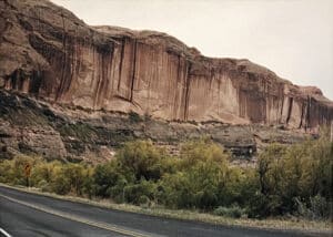
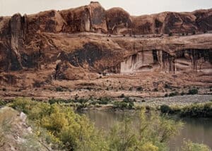
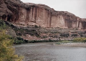
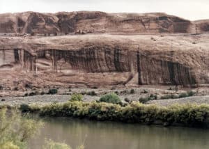
The paved road led back along the Colorado, just a little above the level of the river. The canyon was less deep here, with something of a flood plain. There were signs of human habitation along here, some dug out of the cliff, and at one point, there was a cliff with some Anasazi petroglyphs, with a primitive wooden ladder leading up the cliff. It seemed clear that we were NOT to climb the ladder, and no one seemed inclined to do so.
Back in Moab, we rode back to WSC, unloaded our gear from the river-runner bags, said good by to the WSC staff and thanked them for the adventure and their care for us. Lou Warner said to me, “Dan—awesome!” meaning, I assume, that it was awesome to see an old guy like me more or less keeping up with the kids, and not killing myself and wrecking his rental bike on some of the rocky slopes we’d negotiated. I was quite pleased, in any case.
Leigh and Jason and most of the others headed back toward Santa Cruz that afternoon. They had to get back to work. I picked up a rental mini van in Moab, and Mark and Caroline, and Scott, a friend of Caroline’s, and I drove up to the campground on Sand Flats at the Slickrock Trail, and camped there. Scott had a 4WD truck with a cap, that he slept in. Mark and Caroline slept in the back of her 4WD SUV, and I rolled out my sleeping bag on a level part of the slick rock, where I could watch the stars until I fell asleep. There was a full moon that night, and I was serenaded by nearby coyotes. They howled a lot, and sounded very close. It made me a little nervous, though I was pretty sure they didn’t bother people.
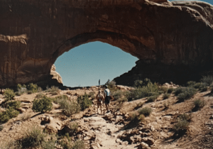
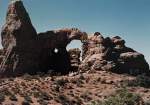
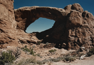
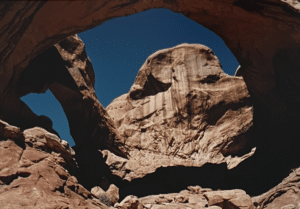
Next day, Scott rode off to do the Slickrock Trail again, and Mark, Caroline and I drove up the highway from Moab to the Arches National Park, to take pictures. Around noon, they said good by, and started back to Santa Cruz. I drove back to the camp site in my rented van. That evening, Scott and I drove in to Moab and ate dinner in a Mexican restaurant. Then back to the camp to look at the stars and listen to the coyotes. Backing in to the camp site, I found a picnic table in the dark, and pushed it back several feet. Unfortunately, it didn’t meet the van’s bumper, and the result was a dent in the van, but no noticeable damage to the picnic table.
Next morning, Scott and I said good by. He was going to drive back to California that day. I drove back down into Moab, turned northeast along the Colorado on Route 128, taking pictures occasionally, and headed back to Grand Junction to turn in the van, fess up that I’d dinged it a bit, and catch the plane to Denver on the way back to National. We had not gotten to ride on single track up in the Abajos, but even though we’d had to settle for jeep roads in the desert, it had been an awesome adventure, as the people who ride mountain bikes are inclined to say.
Epilogue: A month or so after the trip, Mark called to say he had a picture of me taken on the trip, and he wanted to use it in an ad for Rock Shox, along with a biography. He thought he might be able to wangle some schwag for me as a model fee possibly a Rock Shox fork. (“Schwag”, or “swag”, is a biking industry term for the freebies that grease the wheels of commerce in that industry.) I said sure; I’d like to have front suspension on my mountain bike, although it didn’t seem necessary for the mild east-coast riding I did. And I looked forward to being famous. We worked out a short and somewhat truthful bio, and in due course, I got the fork, and a copy of a Utah tourism promotion magazine, with my picture and bio.